If you’ve never ordered a boundary survey before, it can feel like stepping into unfamiliar territory. However, once you understand what it is and how it works, the process becomes much less intimidating. A boundary survey gives you more than just lines on a map—it gives you certainty. Whether you’re buying land, planning a construction project, or simply protecting what you already own, this survey is one of the smartest investments you can make.
What Is a Boundary Survey and Why It Matters
A boundary survey is a precise measurement of your property’s lines, corners, and dimensions. Licensed surveyors use specialized equipment to determine exactly where your land begins and ends based on legal records. In San Diego, where property values are high and lot shapes can be irregular, knowing your exact boundaries can prevent costly disputes and delays.
Unlike a simple property sketch, a boundary survey produces an official document that can be used for permit applications, resolving neighbor disagreements, or finalizing a real estate transaction. In short, it answers the critical question: What exactly do you own?
When You Should Get a Boundary Survey
Timing makes a big difference. Ordering a survey before buying a property ensures you know what you’re getting. It’s also wise to arrange one before building an addition, installing a fence, or starting any project close to a boundary line.
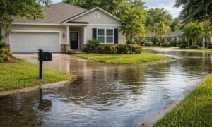
In many older San Diego neighborhoods, property improvements like fences, retaining walls, and driveways have been in place for decades. Without a survey, you might not realize that part of a structure is outside your legal lot—or that a neighbor’s improvement extends into yours. Catching these issues early can save money and prevent legal trouble.
How a Boundary Survey Works
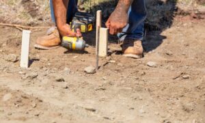
The process begins with hiring land surveyor who understands local land conditions, permitting rules, and property history. They start by reviewing deeds, plats, and historical records to determine how your land was originally defined. Then, they conduct on-site measurements using advanced tools such as GPS units and total stations.
When the fieldwork is done, you’ll receive a detailed map showing your property lines, marked corners, and any encroachments or recorded easements. In coastal or hilly areas of San Diego, the surveyor may also note features like shoreline markers, steep slopes, or retaining structures that can affect property limits. This map serves as a reliable reference for future planning and transactions.
Common First-Time Mistakes You Can Avoid
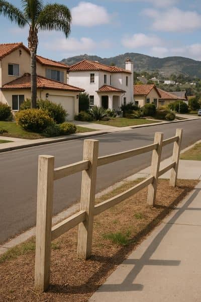
One mistake is assuming that existing fences or landscaping mark the true legal boundary—they often don’t. Another is delaying the survey until after construction begins, which can result in violations of setback rules or building codes.
Choosing a surveyor based solely on price is another pitfall. Hiring someone familiar with San Diego’s neighborhoods, topography, and municipal requirements ensures a smoother and more accurate process.
How to Use Your Boundary Survey Once You Have It
A completed boundary survey is more than a record to store away. It can be used to secure building permits, guide landscaping projects, and address property line questions before they escalate. Real estate professionals and attorneys also rely on it during property sales to verify that the legal description matches the actual land.
With a survey in hand, you can move forward knowing your plans align with local rules — and by working with trusted San Diego property survey services, you’ll get expert help to maximize its value.
Final Thoughts
Getting your first boundary survey doesn’t have to be overwhelming. With the right professional and a clear understanding of the process, you’ll gain accurate information that safeguards your investment, prevents disputes, and supports your projects from start to finish. Partnering with a licensed land surveyor in San Diego ensures that you get both precise results and valuable local insight.
FAQS
1. Will a boundary survey show easements or rights-of-way?
Yes. If they are recorded in your property’s legal documents, the survey will show them on the map. In San Diego, this might include utility access lanes, shared driveways, or pedestrian pathways that could impact property use.
2. Can a boundary survey help with future renovations?
Absolutely. A current survey gives architects and contractors clear property data, helping them design projects that meet setback rules and zoning requirements.
3. What happens if the survey shows a neighbor is using part of my land?
If encroachments are discovered, you can address them promptly—whether by having a conversation, negotiating an agreement, or seeking legal advice.
4. Do I need to be present during the boundary survey?
It’s not required, but being there lets you ask questions and see exactly where property markers are placed.
5. How is technology changing boundary surveys?
Surveyors now use GPS, drones, and laser scanning to collect data quickly and accurately, reducing turnaround times while improving precision.