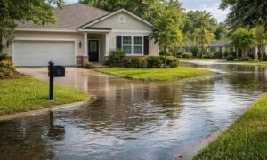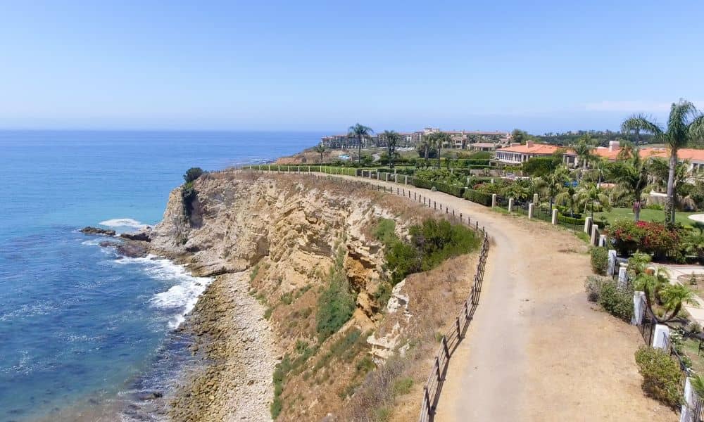
When the Rancho Palos Verdes bluff collapsed in late September, news cameras showed luxury homes sliding toward the ocean. It was shocking, but for homeowners in San Diego, it felt uncomfortably close to home. Our coastline has the same steep cliffs, the same erosion issues, and the same risk. If you live near the bluffs in Del Mar, La Jolla, or Encinitas, the event was a reminder: owning coastal property is more than a view. It’s a responsibility. And one tool that helps protect that investment is a boundary line survey.
A boundary line survey does more than mark corners on a map. Along the coast, it shows you exactly where your legal property ends and where natural hazards begin. In places where the ground itself may be moving, that knowledge matters.
Why San Diego Should Pay Attention
San Diego’s coastal bluffs have been in the spotlight for years. Train tracks run dangerously close to the edge in Del Mar, forcing the region to spend millions on stabilization and long-term relocation plans. Erosion here isn’t hypothetical — experts estimate some sections retreat six inches each year.
That number may not sound huge, but over time it changes property lines, undermines structures, and threatens safety. Just like Rancho Palos Verdes, many of our coastal neighborhoods are filled with homes built decades ago, long before today’s setback and hazard rules. For current owners, that means the ground under your property may not match what’s written in your deed.
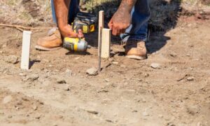
This is where a surveyor steps in. A boundary line survey clarifies exactly how much land you own today and how that land interacts with bluff edges, drainage paths, and public easements.
Beyond Fences and Corners
People often think of surveys in terms of fences or neighbor disputes. But along San Diego’s bluffs, a survey is about much more. Imagine trying to design a deck, a new retaining wall, or even an accessory dwelling unit without knowing if your legal setback has shifted closer to the cliff. That could lead to expensive permit denials or worse — building something that later fails inspection.
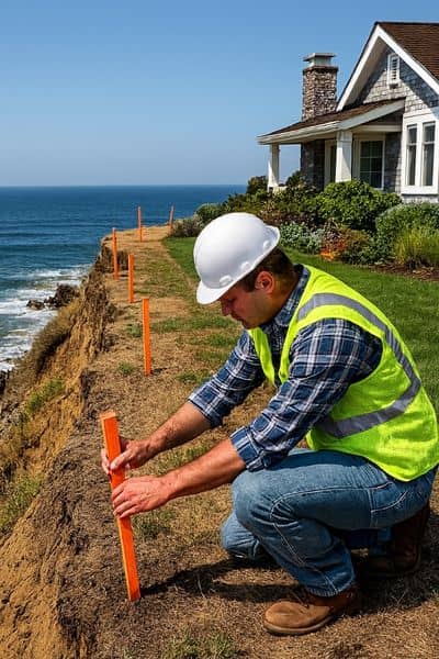
A coastal boundary line survey accounts for both legal records and physical realities. It links your deed to on-the-ground evidence: the bluff edge, visible cracks, drainage outlets, and even signs of soil movement. Surveyors record these details so you have a baseline map that can be compared over time.
That baseline is powerful. It tells you not only where your property line sits today, but also what changes may be creeping closer to your home.
What Makes Coastal Surveys Different
If you live inland, a boundary line survey may be fairly straightforward. But near the coast, the process involves more layers:
- Geologic hazard zones. Surveyors check if your property falls into official erosion or landslide hazard designations.
- Setback verification. The distance from the bluff edge to your buildable area must meet city and state rules.
- Ground movement. Signs of cracks or leaning structures often show up in survey notes, giving you early warnings.
- Drainage impacts. Runoff patterns that accelerate erosion are mapped and flagged.
- Vertical benchmarks. Surveyors record elevation so you can measure future bluff retreat against today’s numbers.
- Drone imagery. Many coastal surveys now include aerial photos that can be repeated in future surveys for comparison.
These details are more than technical notes. They provide a clear picture for architects, engineers, and city reviewers, helping your project move forward without surprise delays.
Permits and Paperwork You Can’t Ignore
Living near the bluff means living with rules. The Coastal Development Permit process is strict, and for good reason. The city wants to ensure that new construction won’t worsen erosion or put people in danger.
A boundary line survey is often one of the first documents required when you apply for permits. If your project involves grading, retaining walls, or new drainage, the city will ask for proof of property lines and setbacks. Without that proof, your permit may get denied or stuck in endless revisions.
Getting the survey first saves time. It puts you and your design team on the same page, and it prevents wasted money on plans that can’t be approved.
A Homeowner’s Perspective
Think of a survey as insurance. It won’t stop the ocean from moving the bluff, but it will give you the facts you need to make smart decisions. Do you build that new deck? Do you invest in stabilization? Do you challenge a neighbor’s encroaching wall? Those choices are easier when you have a certified map in your hand.
One coastal homeowner in Del Mar recently learned this the hard way. After spending thousands on architectural drawings, she discovered her planned addition was too close to the bluff edge to get a permit. A boundary line survey done earlier would have flagged the issue before she spent a dime on design.
What to Ask Before Building
If you own coastal property, here are three questions worth asking before starting any project:
- Has a surveyor confirmed the line between my property and the bluff edge?
- Does my design sit within the legal setbacks on that survey?
- Could drainage changes from my project accelerate erosion?
If the answer to any of these is “I’m not sure,” it’s time to call a surveyor.
Seeing Is Believing
Numbers on paper can feel abstract. That’s why modern surveys often include visual elements — drone imagery, elevation profiles, and simple diagrams. These images aren’t just for engineers. They help homeowners see, with their own eyes, how close the bluff edge really is and how their structures relate to it.
This kind of evidence also helps with insurance claims, refinancing, or future sales. Buyers and lenders are much more comfortable when they see proof that a home has been surveyed and monitored.
Final Thoughts
The Rancho Palos Verdes collapse was a dramatic reminder that coastal land is fragile. For homeowners, it underscored how much is at stake. Views can disappear overnight. Property values can crumble if the ground beneath isn’t secure.
A boundary line survey is not a luxury in this environment. It’s a practical, necessary step that protects your investment, keeps your projects legal, and gives you peace of mind. In coastal neighborhoods, working with professional land surveying gives you a clear picture of where your property truly begins and how shifting terrain might affect it over time.
If you own a bluffside property in San Diego, don’t wait for erosion to make choices for you. Partnering with a licensed surveyor gives you clarity about your land and the confidence to plan your future wisely.