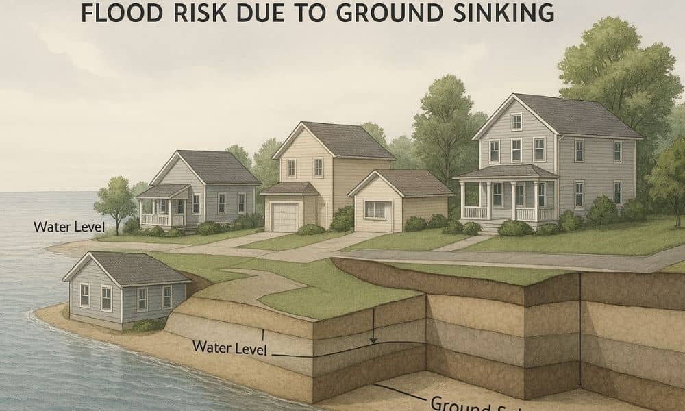
If you live or own property, you may have seen recent news about parts of the region slowly sinking. The changes are small, often measured in millimeters, yet they matter more than most people realize. When the ground shifts, flood risk can change too. That’s why a flood elevation survey is becoming more important right now, especially for coastal and low-lying properties.
San Diego’s land has always been shaped by water, soil, and movement. However, recent reports have pushed this issue into the spotlight. They show that ground sinking, also called land subsidence, is happening quietly beneath neighborhoods, roads, and buildings. While it doesn’t feel dramatic day to day, it can affect how high or low a property sits compared to flood levels.
What ground sinking really means for property owners
Ground sinking doesn’t look like a sudden collapse. Instead, it happens slowly as soil compresses or groundwater levels change. Because the movement is gradual, most property owners never notice it. Still, elevation plays a major role in flood safety. Even small shifts can change how water flows during heavy rain or storm surge.
In San Diego, many flood risk decisions rely on elevation data that assumes the ground stays stable. When that assumption no longer holds true, problems can follow. For example, a home that once sat safely above a flood threshold may now sit closer to it. As a result, flood exposure increases even if the building itself hasn’t changed.
Why flood risk depends on accurate elevation
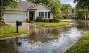
Flood risk isn’t just about how close you are to the coast. It also depends on how high your property sits compared to nearby water sources. Drainage systems, floodplains, and coastal zones all rely on elevation data to predict where water will go.
When land subsidence lowers the ground surface, it reduces the margin of safety. In turn, this can affect flood insurance costs, building approvals, and even resale value. While these changes may seem small, they often carry big consequences.
Because of this, accurate elevation data matters more now than it did years ago. Old measurements may no longer reflect current conditions, especially in areas affected by slow ground movement.
The hidden risk of relying on old elevation data
Many property owners assume that once elevation is measured, the data stays valid forever. However, elevation surveys capture a moment in time. They do not account for changes that happen years later.
This creates a hidden risk. A property may have passed flood-related checks in the past, yet conditions beneath it may have shifted since then. As a result, decisions based on older reports can lead to surprises. These surprises often show up during permit reviews, insurance renewals, or property sales.
That’s where a flood elevation survey becomes critical. It helps confirm whether your property’s elevation still aligns with today’s flood standards, not yesterday’s.
Who should be paying attention
Not every property faces the same level of risk. Still, certain situations call for extra awareness. Homeowners near the coast, bays, rivers, or drainage channels should stay informed. These areas are more sensitive to even minor elevation changes.
Buyers and sellers should also pay attention. During a transaction, outdated elevation data can delay closing or trigger last-minute concerns. Likewise, homeowners planning renovations or additions may face unexpected design changes if current elevation doesn’t match earlier records.
In all these cases, updated elevation information can prevent stress and added costs.
Why a flood elevation survey matters more right now
A flood elevation survey does more than check a box. It verifies where your property stands today. With ground conditions changing, this verification step becomes essential.
Recent reports highlight that land subsidence is not a future problem. It’s happening now. Because of that, relying on old assumptions can be risky. A current survey helps confirm whether flood risk levels still apply or need to be reassessed.
Instead of reacting after a problem appears, property owners can use updated elevation data to plan ahead. This proactive approach often saves time, money, and frustration.
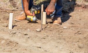
How land surveyors help reveal subtle changes
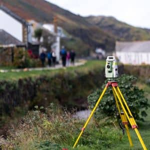
Licensed land surveyors play a key role in identifying elevation changes that aren’t visible to the eye. They compare current measurements with established references to detect shifts over time. These changes may be small, yet they carry real meaning for flood risk and planning.
Because the work requires precision and local knowledge, experience matters. Surveyors familiar with terrain understand how coastal conditions, soil types, and development patterns interact. As a result, they can provide clear insight into whether elevation assumptions still hold true.
Why timing matters more than ever
It’s easy to put off checking elevation until there’s a reason. However, waiting often creates pressure. Insurance reviews, permit deadlines, or sales timelines don’t leave much room for surprises.
Right now, the conversation around ground sinking makes timing especially important. As awareness grows, regulations and reviews may follow. Property owners who stay ahead of the issue place themselves in a stronger position.
By confirming elevation sooner rather than later, you reduce uncertainty. You also gain peace of mind knowing your decisions are based on current conditions.
The bigger picture for San Diego’s future
San Diego continues to grow, and development depends on accurate data. Ground subsidence adds a new layer of complexity to planning and risk management. While the changes happen slowly, their impact spreads across infrastructure, housing, and coastal safety.
Flood elevation data supports smarter decisions at every level. From individual homeowners to city planners, knowing the true elevation of land helps protect investments and communities.
Final thoughts
Ground sinking may not grab attention the way earthquakes do, yet it quietly changes the landscape. As recent reports show, San Diego is not immune to this slow movement. Because flood risk depends on elevation, these changes matter.
A flood elevation survey helps property owners understand where they stand today, not years ago. In a time when conditions are shifting beneath our feet, that clarity is more valuable than ever.