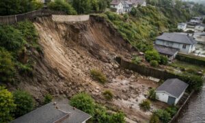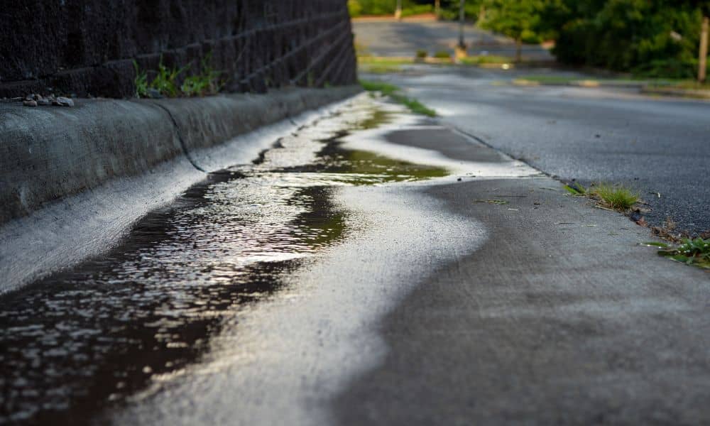
San Diego has been hit hard again by another atmospheric river. In just a few hours, several neighborhoods watched roads flood, hillsides shift, and muddy water rush through places that usually stay dry. When storms like this hit, they reveal something most homeowners and builders don’t think about until it’s too late: the land’s true shape. And that’s exactly why every hillside project needs a topographic survey before any construction begins.
Heavy rain does more than get everything wet. It exposes weak spots. It shows where water really flows and where it pools. It uncovers grading mistakes made years ago. And it tests whether a property was designed with real-world conditions in mind. When 2 to 4 inches of rain fall in a single storm, you quickly see if a site was prepared—or if it was built on guesswork.
Why Atmospheric Rivers Are a True Test of Your Land
San Diego gets storms every winter, but atmospheric rivers are different. They dump huge amounts of water in a short amount of time. As a result, hillsides soften, low areas flood fast, and anything with poor drainage turns into a temporary river.
You probably saw the videos: cars stuck in rising water, backyards turning into ponds, and mud sliding down steep slopes. These scenes are shocking, but they’re also predictable. Whenever a storm hits this hard, the land reacts based on its actual shape, not the shape someone thought it had.
That’s the big problem. Many properties rely on old maps, outdated grading plans, or rough assumptions about the slope. But storms like the one this week prove that small errors can turn into major damage.
And that’s where a topographic survey becomes essential.
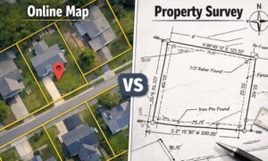
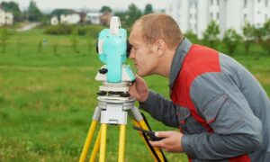
What a Topographic Survey Tells You That Your Eyes Can’t
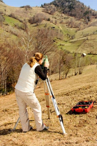
A topographic survey maps a property’s actual elevations, slopes, and drainage paths. I don’t know. It measures. And that difference can save you thousands of dollars and months of rebuilding.
During a strong storm, you see how water behaves naturally. A topographic survey captures that behavior with numbers and contour lines, which helps you understand:
- Where water naturally wants to flow
- How steep different parts of your land really are
- Which areas sit lower and may flood
- Whether a slope could erode or slip
- How runoff from a nearby hill will hit your project
- And whether the land is safe for construction at all
In normal weather, these details stay hidden. The ground looks solid. The slope looks gentle. The backyard looks flat. But an atmospheric river doesn’t care about what things look like. It
San Diego Hillsides Make Rainfall More Dangerous
San Diego has beautiful terrain. We have canyon edges, mesa tops, sloped lots in La Jolla, and hillside homes overlooking Mission Valley. But those same features make storms risky, especially during winter.
Here’s what often happens during big rain events:
1. Water rushes down steep grades
In places like La Jolla or Del Cerro, stormwater runs downhill quickly. If the slope is steeper than expected, that “small” flow can become a force strong enough to flood garages or undercut retaining walls.
2. Canyons overflow and backflow into yards
Mission Valley is a classic example. When the San Diego River rises, even areas that look safe can suddenly end up underwater if the land slopes toward the river.
3. Loose soil slides after long rain
In areas like Sorrento Valley and Rancho Peñasquitos, wet soil can shift. Even a small slide can break fences, crack foundations, or damage landscaping.
All of these problems become worse when a project starts without accurate elevation data. A topographic survey gives builders, engineers, and homeowners a clear picture of the site before making any big decisions.
Why You Shouldn’t Start Any Hillside Project Without a Topographic Survey
Imagine you’re adding a retaining wall, building a home addition, installing a pool, or planning a new outdoor space. You might think the land looks straightforward. But a recent storm proves otherwise.
When heavy rain hits:
- A “flat” area might turn out to have a slight dip that collects water.
- A hillside that looks stable might start to erode.
- Runoff from your neighbor’s property might flow into yours.
- A planned patio or ADU might sit in a natural drainage path.
A topographic survey reveals all of this before you spend money on drawings, materials, or permits. It helps your engineer design drainage that actually works. It prevents your contractor from guessing. And it keeps your project from failing when the next atmospheric river arrives.
Even better, it gives you a strong position if neighbors complain about runoff. With surveyed data, you can prove your grading follows the natural flow of water—not the other way around.
What Happens When You Skip the Survey
Skipping a topographic survey seems like a quick way to save money, but it often leads to expensive problems, such as:
- Water flowing toward your foundation
- Flooding in basements or lower-level rooms
- Cracked retaining walls
- Soil erosion and slope failure
- Costly redesigns during construction
- Insurance claims denied because site conditions were not evaluated
- Project delays from the city due to grading issues
Storms make these mistakes obvious. And once a storm exposes them, fixing the damage can cost far more than doing the survey upfront.
The Best Time to Order a Topographic Survey
Many homeowners wait until the city asks for a survey, but that’s the wrong approach. The best time is before design starts.
You should order a topographic survey when:
- You’re building on or near a hillside
- You’re planning a pool, ADU, or major backyard project
- Your land sits near a canyon or drainage path
- You’re worried about flooding or runoff
- You’re preparing permit drawings
- Your property has never been surveyed clearly
Think of it like checking the foundation before building the house. You want to know the land’s true shape early, not halfway through construction.
Storms Are a Warning—Not an Isolated Event
Atmospheric rivers are becoming more common, and each one brings the same message: your land will reveal its weak spots. If you understand those weaknesses early, you can design smarter, build safer, and protect your investment.
A topographic survey gives you that understanding. It turns guesswork into clarity and helps you avoid the stress, cost, and damage that storms bring.
Final Thought
If this week’s storms made you wonder whether your hillside property is truly safe, now is the right time to act. Before you build, grade, or design anything, get a clear look at how your land behaves. A topographic survey could be the difference between a strong project and a costly mistake when the next atmospheric river hits San Diego.