If you’re building or remodeling, hiring a construction surveyor early can save you from big headaches later. With beaches shrinking, stricter permits, and changing terrain, you need a site plan that’s 100% accurate. A surveyor’s job is to make sure your design fits your land—and meets city rules—before the first shovel hits the ground.
San Diego’s Changing Coastline Is Changing the Rules
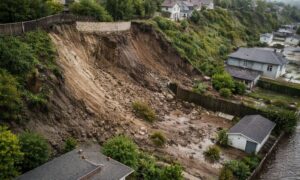
Local news has been talking about San Diego’s beaches disappearing faster than expected. Groups like the Surfrider Foundation say the loss of sand and bluff erosion could reshape parts of the coast. That means property lines, drainage, and even setback rules are shifting too.
For anyone building in these areas, this isn’t just news—it’s a warning. If your project doesn’t match the city’s latest data, your permit can be delayed or denied. That’s where a construction surveyor comes in. They make sure your plan is accurate and follows city standards, even as the landscape changes.
What a Construction Surveyor Actually Does
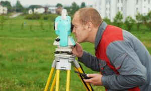
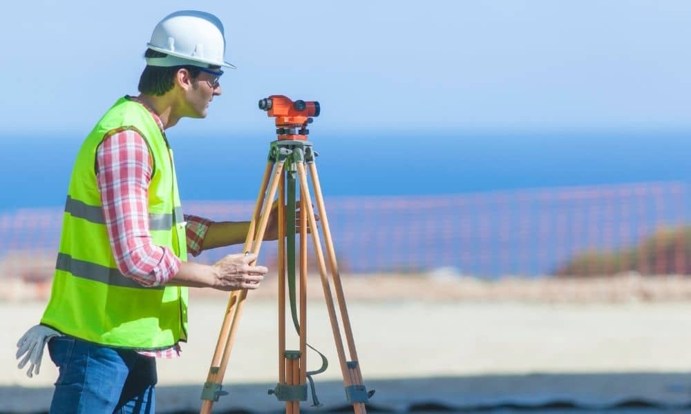
A construction surveyor takes your blueprints and marks them out on your property. They show your builder exactly where to dig, pour, and build. They also check that the elevations and slopes on your land line up with the plans.
You can think of them as your project’s “navigator.” Your builder builds; your surveyor makes sure it’s built in the right place. In San Diego’s tricky terrain—where a few inches can change drainage or stability—this accuracy is worth every penny.
Why San Diego’s Terrain Makes It Tricky
San Diego isn’t flat. It has hills, canyons, bluffs, and sandy soil near the coast. Each type of land affects how a structure handles water, gravity, and weather. Surveyors have to adjust to all that.
Even fog can affect field work. The National Weather Service recently warned about thick morning fog in the area. That kind of weather can make measuring harder and less safe. To work around it, surveyors use modern GPS and total station tools that stay accurate even when visibility drops.
Step-by-Step: How a Construction Surveyor Builds a Site Plan

Step 1: Research the Records Before visiting your site, a surveyor studies maps and records from San Diego County. They check boundaries, zoning, and flood zones. If your property is near the coast or a bluff, they’ll also look up FEMA flood maps and the right elevation benchmark, like NAVD88.
Step 2: Collect Field Data Next, they visit your site. Using GPS and measuring equipment, they record elevation points, slopes, and utilities. They look for control points—spots the city uses as official references. Those control points help your survey match the city’s system exactly.
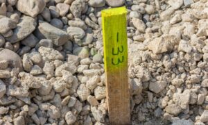
Step 3: Layout and Staking After processing the data, the surveyor stakes your lot. Each stake marks where foundations, walls, and utilities should go. Builders then follow these marks to make sure the project matches the approved plan.
If you’re near the coast, this might include staking retaining walls or drainage lines based on city setback rules.
Step 4: Verify and Finalize the Plan Once the field work is done, the surveyor prepares a site plan that shows every elevation, slope, and boundary. They’ll make sure it follows Coastal Overlay Zone and flood rules. The finished plan is ready for city submission or engineering design.
Mistakes That Slow Down Projects
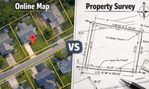
Skipping a survey or using an old one can cost time and money. Old data might not match the city’s benchmarks anymore. Some property owners use online GIS maps, but those aren’t accurate enough for permits.
Another problem is using an unlicensed drafter. Only a licensed construction surveyor can certify your plan. Without that certification, the city might reject your application.
How Erosion and Flood Risk Change the Job
San Diego’s erosion and flooding problems are making surveyors work smarter. Many now use drones to take aerial photos and measure elevation changes. These drone surveys capture the shape of the land in detail, helping engineers fix drainage or slope issues before construction begins.
Over time, even inland projects may need updated elevation data or flood elevation certificates. That’s why having a surveyor who understands both ground and aerial data keeps your project safe and compliant.
What to Expect When You Hire a Construction Surveyor
A professional surveyor should:
- Have a valid license (PLS).
- Explain which benchmarks they’ll use.
- Deliver your plan in CAD and PDF formats with clear elevation notes.
- Work with your builder or engineer to schedule layout work.
- Plan for site conditions, weather, and safety.
Simple site plans usually start around $2,000, but coastal or sloped areas may cost more. The extra accuracy prevents costly rework and speeds up permit approval.
Building Confidently on Shifting Ground
San Diego’s landscape is always changing, and the rules are changing with it. Between coastal erosion and new regulations, precision isn’t just about accuracy—it’s about protecting your investment.
A skilled construction surveyor helps you build safely and confidently, no matter how the ground moves. So before you start your next project, make sure your site plan is right the first time—because in San Diego, the land won’t wait for you to catch up.