San Diego is growing fast, and many projects now depend on drone survey work to stay accurate and on schedule. Builders use drones for early site planning, grading checks, and tracking progress as work moves forward. At the same time, California is making a change that could shape the future of this work. The California Land Surveyors Association (CLSA) in San Diego recently announced a new hybrid LS Exam Review program. This program makes it easier for more people to enter the surveying profession. It may seem like a small update, but it could bring big changes to drone survey teams across the region.
A New Licensing Path That Brings More Surveyors
For years, many survey workers wanted to move toward licensure, but long drives, strict schedules, and limited in-person classes made it tough. The new CLSA hybrid course changes that. It mixes online lessons with in-person sessions at Caltrans District 11. This setup gives students more time, more support, and a better chance to prepare.
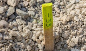
When more people can train and pass the exam, the whole industry grows. This matters in San Diego because licensed surveyors guide the technical side of drone mapping. They set control points, review data, and sign off on results that engineers depend on. As more candidates enter the pipeline, more licensed surveyors will be ready to oversee drone survey work.
Why Licensing Matters for Drone Survey Results
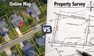
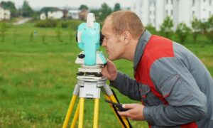
Many people think drone surveys are simple—just fly a drone and take pictures. But real drone survey work is much more detailed. It involves special tools, strict rules, and careful measurements. In California, a licensed professional must manage survey-grade drone mapping. This keeps the work legal and makes sure the data is accurate for planning or permits.
Because licensed surveyors hold this responsibility, they become the “key point” in the workflow. When demand rises, they often have more work than they can take. Builders must wait for openings, which slows projects down. With more licensed surveyors entering the field, firms can grow their teams. That means drone surveys can happen faster, and clients get results sooner.
A City That Needs More Drone Survey Work
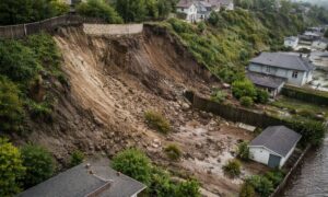
San Diego’s construction boom is placing extra pressure on the surveying industry. New housing, mixed-use buildings, and coastal projects all need mapping before design begins. Many of these sites are large, steep, or busy, making them hard to measure on foot. Drone surveys solve that problem by collecting detailed 3D data in a short time.
Developers like drone surveys because they give clear maps, surfaces, and models that help guide early design decisions. Engineers then use the data to plan earthwork, locate buildings, and study drainage. As more projects start, the need for drone survey services keeps rising. Licensing changes can help meet this demand by increasing the number of people who can lead the work.
Faster Results for Homeowners and Builders
More licensed surveyors mean more teams and quicker scheduling. Instead of waiting weeks for a drone survey, clients may see shorter wait times. This matters during busy seasons when every day counts. When surveys happen sooner, design starts sooner, and permits can move forward faster.
Homeowners also benefit. Many need surveys for ADUs, fences, additions, or small grading work. These jobs often fall behind large commercial projects. With more surveyors available, smaller projects get done sooner and with less stress.
Better Quality and Smoother Workflows

The new licensing path doesn’t only increase capacity. It also raises the overall quality of the work. Students preparing for the LS exam learn modern tools such as UAV mapping, GPS methods, and digital processing. They study how to blend drone data with ground points to create accurate maps.
With more surveyors trained in these updated methods, clients get clearer, more reliable results. Engineers receive cleaner surfaces. Contractors get better grading information. Owners get stronger insights for early planning. Over time, this builds trust in drone survey work across the region.
Faster Adoption of New Technology
Surveyors entering the field through a modern training program often have a strong interest in new technology. They learn the latest tools and software during their studies, which helps firms upgrade sooner. This may include:
- RTK drones for high-accuracy mapping
- Drone-based LiDAR for areas with trees
- Cloud tools for fast data sharing
- 3D models for visualizing cuts and fills
With more tech-minded professionals, clients enjoy better results and more choices. A site that once took days to measure may now be mapped in under an hour, with a complete model ready in a few days.
Support for Big and Long-Term Projects
San Diego’s growth includes more than private buildings. Road improvements, utility work, and coastal protection projects all rely on drone mapping. These jobs often need multiple surveys over long periods. With more licensed surveyors in the field, drone survey teams can handle bigger workloads without slowing down smaller clients.
Public agencies also benefit. Cities and counties can work with more qualified teams when planning improvements or studying changes in sensitive areas.
What Clients Can Expect as Licensing Expands
As more students enter the new licensing program, clients will start to notice real changes. Scheduling becomes easier. Deliverables arrive faster and with more detail. Pricing becomes more stable as more firms enter the market. Most importantly, clients gain confidence knowing their drone survey results meet California’s strict standards.
Though the change will take time, the long-term result is clear: San Diego will have a stronger, more flexible surveying workforce ready to support the city’s rapid growth.
A New Chapter for Drone Survey Work
The CLSA’s new licensing program marks an important shift for land surveying. By opening the door to more students, the industry will see new talent, better tech skills, and stronger support for all types of projects. Since drone survey work relies on licensed leadership, this growth will help the entire construction pipeline.
San Diego is expanding quickly, and every project needs accurate mapping to move forward. With better access to licensing and more trained professionals entering the field, drone surveys will become faster, clearer, and more reliable. This brings real value to homeowners, builders, engineers, and developers who are shaping the city’s future.