Land Surveying: Estimating the Cost

Land surveying, in short, is the science and art of establishing or re-establishing property corners, property lines and/or boundaries. There are different reasons why someone wants a lot surveyed.

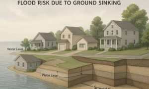
Essentially the most common is to check if a piece of land is vulnerable to flooding, to subdivide a property to sell or to determine if there are any encroachments. This may happen if a neighbor disputes that you are using a piece of his lot or vice versa (for more on this, go here).

The Cost of Land Surveying

If you need to have a piece of land surveyed, the first thing that will come to mind is “how much will it cost?”There are plenty of factors determining exactly how much land surveying for your land would cost.

The fact that this type of service must be carried out by an expert contributes a great deal to the overall cost of the service, but choosing a non-professional to survey your land is dangerous and possibly illegal for the non-professional. Because of this you have to take a good look around before settling with a surveying company.

If you must work within a particular budget, discuss this with the surveyor up-front. Very often he may be able to offer cost saving steps to get the work you need done within these cost limits. The form of the land must also be looked into. A square or even a rectangle piece of land is somewhat easier to survey than an odd shaped parcel, or one with many different sides.

With the latter, the surveyor would have to take more time in surveying the curves as well as the bends which means the cost of the service would go higher.

The overall measurements the land is also key factor here. Understand that the cost of land surveying is normally proportionate to the time and effort that the land surveyor would spend on the project. If the land that you’re having surveyed isn’t accessible, or has thick vegetation, then the total price of the survey might go higher.

This is true of the varying weather conditions that might impact the work. Surveying in warm weather is somewhat slower to keep from putting the crew members in danger. Also, most surveying can’t be done in the rain.

When requesting for an estimate, bear in mind that surveyors base the estimate on expected conditions at the site. These conditions could change, bringing about additional costs. Always ask about these potential additional cost scenarios.

All that being said, competitive prices are also to be expected, this is why we recommend deciding on a surveyor based upon his experience and reputation rather than on the price he writes on a piece of paper. Usually it is better to invest a good amount of money on a survey that’s well-done rather than choose a company with a very “affordable” price but have the survey repeated because the results were wrong.

To sum it up, you should always discuss the expenses of the survey before you decide to ask the surveyor to start his work. It’s also wise to receive a contract that lets you know what is expected of the land surveyor. This is one of the most important steps in getting your land surveyed.
More Posts

Surveyors using total station equipment beside traffic cones on a closed roadway for an alta land title survey
alta survey
Surveyor

How Freeway Closures Affect Your ALTA Land Title Survey

When the I-5 freeway near Camp Pendleton suddenly closed after a live-fire training accident, drivers across San Diego were stuck in long traffic jams. But while everyone waited, survey teams were already preparing to check the land, slopes, and property lines around the area. It’s a good reminder that the

Read More »
Flooded suburban neighborhood with a high water warning sign illustrating why accurate data from a loan closing survey is vital during the NFIP freeze
boundary surveying
Surveyor

NFIP Freeze: How a Loan Closing Survey Keeps Deals Alive

When the National Flood Insurance Program (NFIP) froze on September 30, home deals across the U.S. hit a wall. Here in San Diego, the pause has caused real stress for buyers trying to close on homes in flood-risk zones like Mission Valley, Mission Beach, and parts of Santee. Without flood

Read More »
Coastal bluff with luxury homes near the edge, showing why a boundary line survey is essential for protecting coastal properties.
boundary surveying
Surveyor

Why a Boundary Line Survey Matters for Coastal Homes

When the Rancho Palos Verdes bluff collapsed in late September, news cameras showed luxury homes sliding toward the ocean. It was shocking, but for homeowners in San Diego, it felt uncomfortably close to home. Our coastline has the same steep cliffs, the same erosion issues, and the same risk. If

Read More »
Drone surveying over a forest with smoke rising from wildfire debris
land surveying
Surveyor

Drone Surveying Lessons from a Firefighting Collision

When most people hear about drone surveying, they picture builders saving time or developers mapping large tracts of land. What rarely comes to mind is the risk drones can pose when flown in the wrong place at the wrong time. That reality hit hard in California this month. News broke

Read More »
Cracked and uneven concrete pavement caused by land subsidence, highlighting the importance of land surveying to detect and manage ground sinking.
land surveying
Surveyor

How Land Surveying Helps Combat Land Subsidence Risks

If you live in San Diego, you might not realize that the ground beneath your feet is slowly sinking. This problem, called land subsidence, is happening faster here than in most other California cities. It’s caused mainly by pumping out too much groundwater for drinking and farming. While the sinking

Read More »
Excavator digging a trench near a residential property line, highlighting the importance of a boundary survey before starting construction.
boundary surveying
Surveyor

What Happens When You Skip a Boundary Survey

In Spring Valley, California, a trench became more than just a hole in the ground — it became a war zone between neighbors. What started as a simple retaining wall project turned into a messy, stressful, and very public conflict. And at the center of it all? The boundary survey

Read More »