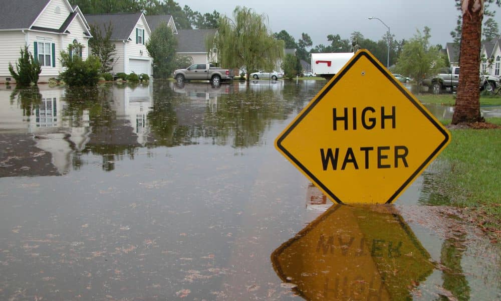
When the National Flood Insurance Program (NFIP) froze on September 30, home deals across the U.S. hit a wall. Here in San Diego, the pause has caused real stress for buyers trying to close on homes in flood-risk zones like Mission Valley, Mission Beach, and parts of Santee. Without flood insurance, lenders can’t approve most mortgages in these areas. That’s where a loan closing survey becomes a lifesaver. This simple but powerful document can help buyers, lenders, and title companies keep the deal moving even while the NFIP is on hold.
The Freeze That Stopped Closings
The NFIP provides almost all federal flood-insurance coverage in the country. When Congress missed the deadline to renew the program, FEMA announced that new or renewal policies could not be issued. That means if you were planning to buy a home in a flood zone, your insurance application may now be stuck—and your loan right along with it.
This isn’t just a Washington problem. For buyers, it’s a deal-breaker. Lenders must prove a property in a high-risk flood area has coverage before releasing funds. With no policy, many deals were suddenly pushed back or canceled.
How San Diego’s Flood Zones Play a Role
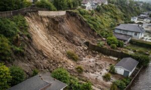
Most people think of flood zones as beachfront property, but San Diego’s maps tell a different story. FEMA’s Flood Insurance Rate Maps (FIRMs) show floodplains reaching deep inland, along the Otay River, Tecolote Creek, and low parts of Mission Valley.
If your home or lot sits in one of these zones, a lender needs to see proof of insurance. When that isn’t possible, the only way to confirm your risk level is by using an updated loan closing survey or elevation certificate.
These surveys reveal whether your home is truly in danger of flooding—or if it’s actually above the base flood level. In some cases, they show the property is safer than FEMA’s map suggests, saving buyers from unnecessary insurance costs and closing delays.
What a Loan Closing Survey Does
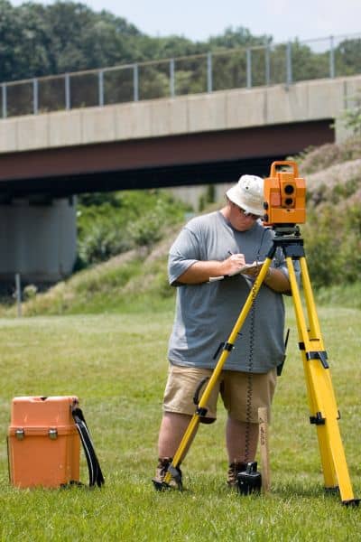
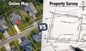
A loan closing survey is done by a licensed land surveyor. It shows your property’s exact boundaries, building footprint, and key elevations. Lenders rely on it to confirm that everything on the land matches what’s listed in public records.
Surveyors use high-precision tools, including GPS and benchmarks tied to the NAVD 88 elevation system. They measure the height of the structure’s lowest floor and compare it to FEMA’s base flood elevation.
If the results prove that the home sits higher than expected, the lender may allow the deal to move forward using private flood insurance or temporary approval. That’s why, during this NFIP freeze, a good loan closing survey has become one of the most valuable tools in real estate.
How Lenders Are Adapting
San Diego lenders aren’t sitting still. The FDIC and National Credit Union Administration (NCUA) recently told banks they can still close certain loans during the NFIP lapse if they follow strict guidelines.
Here’s what that means in practice: If the lender has a verified survey showing the property isn’t at major flood risk—or the buyer can get short-term private coverage—the deal may proceed. The loan closing survey becomes the evidence that supports those exceptions.
Many real-estate agents are now partnering with local surveyors to help clients order surveys early. That way, by the time the lender asks for flood-risk details, the data is already ready to go.
A Mission Beach Example
Let’s say a couple in Mission Beach found their dream duplex steps from the sand. Their lender approved everything—until the NFIP froze. Because the property was technically in FEMA’s “V-Zone,” the lender refused to close without insurance.
The buyers called a local licensed land surveyor for a loan closing survey. The field data showed the lowest floor was actually two feet above FEMA’s flood level. Using that new report, the lender accepted a short-term private policy, and the couple closed on time.
Without that survey, their deal would still be sitting in escrow.
How to Check Your Own Flood Status
If you’re unsure whether your property is in a flood zone, you can check two places:
- The FEMA Flood Map Service Center, and
- The City of San Diego Flood-Risk Portal.
Search your address, zoom in on your lot, and look for color-coded flood areas. If your property falls in Zone A or V, you’ll need documentation showing how high your building sits above the flood level.
That’s where the loan closing survey helps again—it gives you one verified report showing your property lines, elevations, and improvements. For lenders and insurers, it’s the most trustworthy proof you can provide.
Smart Workarounds While NFIP Is Frozen
Until Congress renews the program, homeowners are finding creative ways to keep deals from collapsing. Here’s what’s working:
- Private flood insurance: Several companies now offer temporary flood coverage that satisfies most lenders.
- Updated surveys: Ordering a new loan closing or elevation survey helps confirm if insurance is even required.
- Escrow holdbacks: Some lenders let buyers close now and hold insurance funds until NFIP reopens.
- Stay documentation-ready: Keep digital copies of your surveys, flood maps, and photos handy for quick approval later.
Each step depends on having accurate elevation data. That’s why surveyors are suddenly busier than ever.
Why Acting Now Helps Later
Even after NFIP comes back, this freeze is a reminder that accurate survey data saves time and money. Many older homes were built before modern flood maps existed. Their designations might be outdated or overly cautious.
Getting a loan closing survey today can help you challenge those labels later, reduce insurance costs, and speed up future sales or refinancing. It’s not just a document for lenders—it’s a long-term investment in your property’s value.
Final Thoughts:
The NFIP freeze may sound scary, but it doesn’t have to stop your home purchase. Deals fall apart when information is missing—not when it’s clear. A current loan closing survey provides that clarity.
By verifying your boundaries and elevation, it gives lenders confidence and helps you move forward even in uncertain times. So if your closing feels stuck, don’t wait for Congress to act. Call a licensed land surveyor and get the data you need to keep your deal above water.
Accurate measurements don’t just protect your investment—they keep the dream of homeownership alive, no matter what’s happening in Washington.