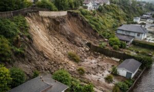
In Spring Valley, California, a trench became more than just a hole in the ground — it became a war zone between neighbors. What started as a simple retaining wall project turned into a messy, stressful, and very public conflict. And at the center of it all? The boundary survey that never happened.
This isn’t just a rare mistake. It’s a lesson for anyone who owns property, especially in older neighborhoods like those found throughout San Diego County.
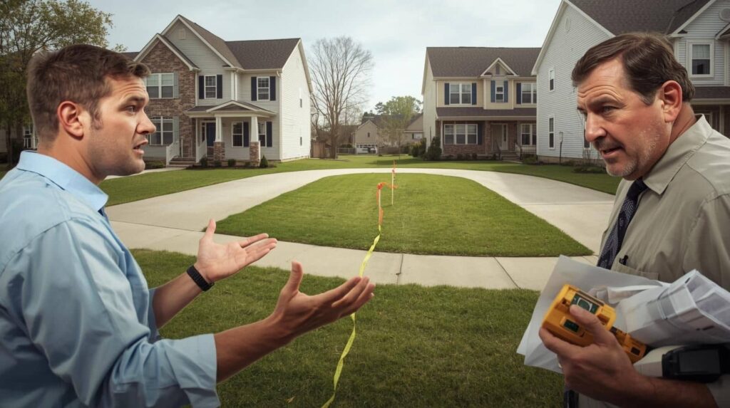
The Trench That Sparked a Fight
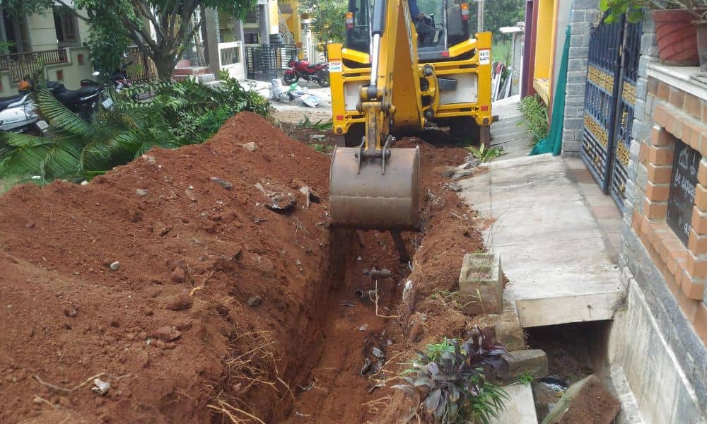
It all began when a homeowner started digging a trench along the edge of their property. The goal? To build a retaining wall — something many homeowners do to manage slopes and soil. But something went wrong.
The trench was left open for months. It cut through a narrow, shared space between two homes. Neighbors were confused and angry. Some said the trench wasn’t even on the right property. Others worried someone could fall in. It became a safety issue, and even local news stations picked up the story.
So why did this happen? Because no one was sure where the actual property line was. And more importantly, no one ordered a boundary survey to find out.
What Is a Boundary Survey?
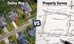
A boundary survey is like a fact-check for your land. It shows exactly where your property begins and ends. A licensed land surveyor uses tools, maps, and legal documents to figure out the true borders of your lot.
In San Diego — where neighborhoods are packed tight and property lines aren’t always clear — boundary surveys are essential. They help avoid mistakes, protect your investment, and keep peace with your neighbors.
In the Spring Valley case, the homeowners assumed they knew where their property ended. But assumptions don’t hold up when shovels hit the ground.
Why Skipping a Boundary Survey Is a Big Mistake
Let’s be honest. Most people don’t think about surveys until it’s too late. It’s easy to assume that a fence marks the line or that your backyard ends where the grass changes color. But those clues are often wrong.
When you skip a boundary survey, here’s what can happen:
- You build on your neighbor’s land without knowing it.
- A neighbor accuses you of encroachment.
- City inspectors get involved.
- Your project gets delayed — or even shut down.
- Legal fees pile up fast.
That’s exactly what happened in Spring Valley. One project became a chain reaction of stress, confusion, and conflict — all because no one took the time to get a clear map of the property.
This Could Happen Anywhere
If you live in San Diego, this story should hit close to home — literally. Many older neighborhoods here were developed decades ago. Property records can be outdated. Lot shapes are often unusual. And when homes are just a few feet apart, every inch counts.
Retaining walls, fences, and driveways are common triggers for boundary issues. And with the city’s hilly terrain, it’s not always obvious where your land ends.
That’s why local surveyors often get called in after a problem starts — instead of before. But by then, the damage is done. Relationships are ruined. Projects are paused. Money is lost.
A Boundary Survey Costs Less Than a Lawsuit
Let’s talk numbers. A professional boundary survey usually costs between $500 and $1,500, depending on the size and shape of your lot. That might sound like a lot — until you consider what’s at risk.
Without a survey, you could face:
- Thousands in legal fees
- Redoing construction work
- Fines from the city
- Years of tension with neighbors
Compared to that, a one-time survey is a smart investment. It gives you peace of mind, legal protection, and a solid foundation for any project you plan.
What Should Have Happened
So, what could the homeowners have done differently? It’s pretty simple — they should have hired a licensed land surveyor before digging.
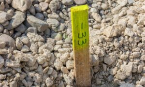
The surveyor would have started by surveying the property lines, digging into the property deeds and maps to figure out exactly where the boundaries lie. Then, using tools like GPS and drones, they’d measure the land carefully on-site. After that, they’d mark those property lines clearly with stakes so everyone knows the exact limits. Finally, the surveyor would provide a certified map that shows those boundaries in black and white.
With that clear picture, the homeowners would have known exactly where to dig — avoiding confusion, keeping the neighbors happy, and staying out of trouble.
Don’t Let This Be Your Story
If you’re planning to build a wall, put up a fence, or do any project near your property line, don’t leave it to guesswork. A boundary survey isn’t just paperwork — it’s your insurance policy against stress, mistakes, and conflict.
And if you’re not sure where to start? Reach out to a licensed land surveyor who knows the local landscape, the permitting process, and the common pitfalls. A good surveyor will walk your land, explain the results, and help you make smart, informed decisions.
Final Thoughts
The Spring Valley trench might seem like just one story, but it’s part of a bigger pattern. As land gets more valuable and space becomes tighter, boundary disputes are popping up more often — and getting more serious.
You don’t need to be part of that trend.
A boundary survey gives you clarity. It keeps your neighbors happy. And it helps your project move forward without costly delays.
So before you dig, build, or even plant a tree near your property line, take the smart step. Call a professional. Get a survey. And save yourself from becoming the next “neighbor at war.”