How a Boundary Survey Can Decide a Land Dispute
Recently, San Diego made headlines after city officials filed a lawsuit against federal agencies over fencing placed near the border. The city claims the fencing crossed onto land it owns. Federal officials argue their work stayed within their authority. While the legal battle continues, one thing stands clear: this conflict centers on property boundaries. At […]
Why Aerial Survey Demand Surges After Storm Damage
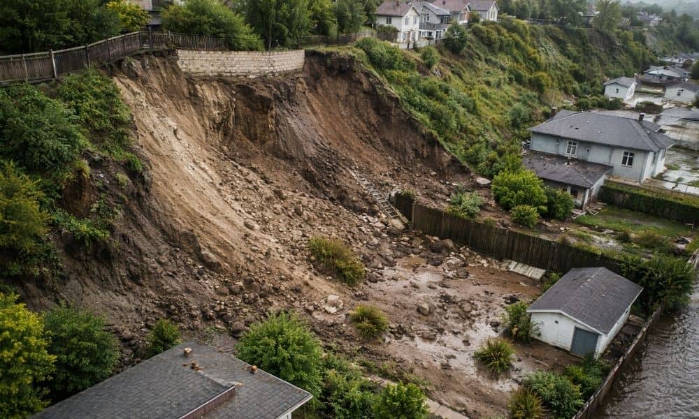
San Diego just went through another round of heavy rain, flood alerts, and coastal erosion warnings. For a few days, everyone talked about road closures and damaged neighborhoods. Then the skies cleared. Life moved on. However, the land does not reset that quickly. After major storms, the ground continues to shift. Soil settles. Drainage patterns […]
Why Your Property Survey Doesn’t Match Online Maps
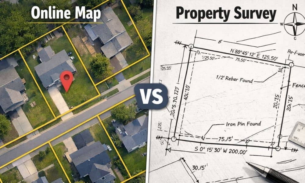
Many people look at online maps and assume the boundary lines they see must be correct. After all, the image looks detailed. The parcel lines appear sharp. The corners seem exact. So when a property survey shows a slightly different boundary, confusion starts right away. However, this situation happens more often than most buyers and […]