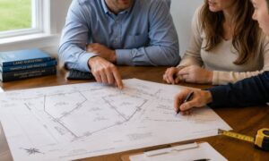
Building an ADU in San Diego feels simple at first. You add a small home in your backyard. Maybe you plan to rent it out or give your family more space. It all seems pretty straightforward. Then plans change. You might decide to sell the ADU later. Or split the property. Or turn it into its own unit with separate ownership. That’s when things start to shift. It’s no longer just about building. It becomes a property decision. Around this point, people start running into things they didn’t think about earlier, like land surveying for ADU projects.
Most owners don’t plan for that part. They focus on design and permits instead. But the land itself sets the limits. It decides what you can and can’t do. If you skip that step, problems show up later, and fixing them can get expensive fast.
Why ADUs in San Diego Are Treated Differently Now
ADUs used to be simple. A guest house. A rental. Something that stayed part of the main home.
Now they carry more value.
Owners start thinking about selling them, refinancing, or setting up shared ownership. Because of that, the city looks more closely at how the land is laid out.
Things like access, layout, and legal boundaries begin to matter more.
As those plans come together, many owners realize they need a land survey for dividing property, even though it wasn’t something they thought about at the start.
Where Parcel Map Problems Begin
Most parcel map issues don’t start with paperwork. They start with assumptions.
An owner assumes the lot can be divided. It can’t.
The driveway seems fine. It actually crosses into a restricted area.
A fence sits in place for years. It turns out to be in the wrong spot.
Utilities run where they shouldn’t, and now they limit what can be done with the property.
These are not rare cases. They happen all the time.
The problem is that none of this is obvious until someone checks the land properly. Old plans, rough measurements, or online maps won’t catch these details.
That’s why many ADU projects hit a wall later, even after money has already been spent.
How Land Surveying Prevents Costly Mistakes
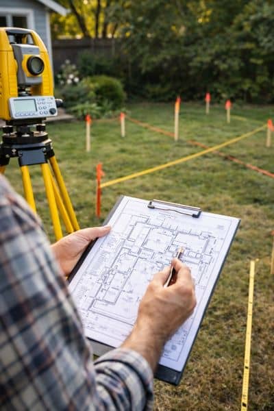
A surveyor looks at the land in a precise way. They don’t guess. They measure and verify.
They confirm where your property actually begins and ends. They check for easements. They look at access points and how different parts of the lot connect.
This information answers key questions early.
Can the lot support a split? Is the access legal? Will the ADU placement cause problems later?
Once you know those answers, you can plan with confidence.
Without that step, you’re building on assumptions. And assumptions often lead to delays or redesigns.
A Situation Many ADU Owners Face
Picture this.
A homeowner builds an ADU behind their main house. Everything goes smoothly. The unit looks great, and it’s ready to use.
Later, they decide to sell it.
Now they find out the driveway crosses an area that can’t be shared the way they expected. The ADU sits closer to a boundary than allowed for a separate setup. The lot can’t be divided without changes.
At that point, the options shrink. The owner may need to redesign part of the property or drop the idea of selling the unit separately.
All of this could have been avoided with early land surveying.
Why Timing Matters More Than Most People Expect
Many owners wait too long to bring in a surveyor.
They finish the design first. They move forward with permits. Sometimes they even start building.
Then they check the land.
By then, changes cost more. Plans need to be adjusted. Approvals take longer.
It’s a frustrating cycle.
Starting with land surveying changes that. It gives you a clear picture before you commit to a design. It helps you avoid surprises that slow everything down.
Early clarity makes every next step easier.
How Land Surveying Fits Into the ADU Process
Think of the process in a simple way.
You have an idea for your ADU. You want it to work long-term, not just today.
Before locking in plans, you check the land. A survey shows what your property allows. That information guides the design, not the other way around.
From there, permits and approvals follow a smoother path.
Without that step, you risk running into conflicts between your design and the actual limits of your property.
Choosing the Right Support in San Diego
Not all projects need the same level of detail. But when ADUs involve future plans like selling or splitting, experience matters.
You want someone who understands how local rules affect property layout. You also want clear answers, not confusing reports.
Ask direct questions.
Can this lot be divided? Is the current access usable for a separate unit? Will this setup create issues later?
Clear answers help you move forward with confidence.
Building With the End Goal in Mind
An ADU can do more than add space. It can become a long-term asset.
But that only works if the property supports your plans.
Land surveying gives you that foundation. It helps you see what’s possible before you invest more time and money. It also helps you avoid problems that show up when it’s too late to fix them easily.
Planning ahead makes the difference.
Check the land first. Then build around what actually works.