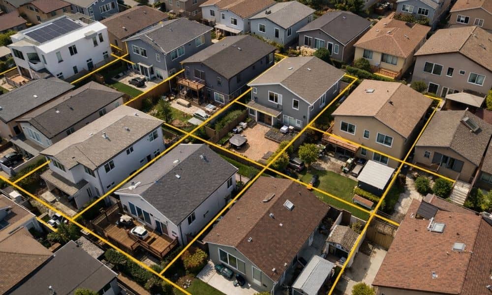
San Diego is moving toward smaller lots, duplexes, and townhome-style housing. That shift may look like a planning or zoning story, but in practice, it creates a very real boundary issue on the ground. A boundary survey is no longer a step that can be delayed or skipped. It is becoming a starting point for projects where space is limited and accuracy matters from day one.
Smaller Lots Change the Margin for Error
As lot sizes shrink, the tolerance for error disappears.
On a larger parcel, being off by a foot might not stop a project. There is often enough space to adjust. In a small-lot or infill development, that same discrepancy can affect setbacks, access, and building placement immediately. The design either works within the boundary or it does not.
That is why a boundary survey carries more weight in San Diego’s current housing environment. It defines the exact limits of ownership based on legal records, physical evidence, and field measurements. Those limits are what architects and engineers rely on when laying out improvements on tight sites.
Without that information, design decisions are based on assumptions. In dense areas, assumptions do not hold up for long.
Density Brings Boundaries Into Focus
Higher density brings everything closer together. Property lines, structures, access points, and utilities all start to sit within a much tighter space. That changes how land is used and how precise each decision needs to be.
In San Diego, this often shows up as:
- Homes built closer to side and rear property lines
- Shared access points between adjacent lots
- Utility lines running near boundary edges
- Drainage and retaining features placed along property limits
When everything is within a few feet of a property line, there is not much room to adjust. Small mistakes can turn into encroachments, failed inspections, or issues with neighboring properties.
This is usually the point where people realize they should have had a verified boundary survey in place earlier. It gives a clear picture of where the line actually is, so everything else can be built around it without second-guessing.
Where Projects Start to Break Down
Most boundary-related problems do not appear during planning. They show up once the project has already moved forward.
A typical scenario starts with a site plan based on parcel maps or approximate dimensions. The layout looks correct on paper. Construction begins. Then something does not align.
A wall sits too close to a line. A driveway crosses onto adjacent property. A setback requirement is not met. A neighbor raises a concern, or an inspector flags an issue.
At that point, the project pauses. A boundary survey is ordered, not to guide the design, but to fix a problem that could have been avoided.
This shift from planning to correction is where delays and additional costs come in. Revisions become necessary. In some cases, improvements must be removed or relocated.
Why Visual References Are Not Reliable
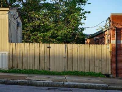
One of the most common issues is relying on what appears to be the property line.
Fences, curb edges, and landscaping often create a visual boundary, but they are not legal indicators. Online parcel maps can also give a general idea of lot shape, but they are not accurate enough for construction decisions.
In San Diego, where properties have been subdivided, modified, or redeveloped over time, these visual references can be misleading. Boundaries may have shifted through recorded documents or may not align with existing improvements on the ground.
A boundary survey accounts for this by analyzing recorded plats, deeds, and prior surveys, then verifying that information through fieldwork. Surveyors locate or re-establish monuments and reconcile any conflicting evidence.
That process produces a defensible boundary that can be relied on for design and construction.
How This Affects Homeowners and Builders
This is not limited to large development projects. It affects everyday decisions made by property owners.
A homeowner planning to build near a side yard may assume the fence marks the line. A contractor installing a new fence may follow an existing alignment without verification. A buyer may rely on listing information to estimate usable space.
These situations carry risk when the boundary has not been confirmed.
In smaller lots, which are becoming more common in San Diego, those risks increase. There is less room to adjust if something is placed incorrectly. A few inches can determine whether a structure complies with local requirements or creates a conflict.
Builders and developers face the same issue on a larger scale. When multiple units are involved, each boundary must be clearly defined and consistent with recorded data. Any discrepancy can affect the entire project layout.
Start Your Project with Accurate Land Data
A boundary survey provides a clear foundation before design and construction begin.
It gives property owners and project teams:
- Verified property lines based on legal records and field measurements
- Identification of encroachments or potential conflicts
- Defined reference points for layout and construction
- Confidence that improvements are placed within the correct limits
Starting with accurate land data allows the rest of the project to move forward with fewer unknowns. It reduces the need for revisions and helps avoid disputes that can arise later.
This approach is especially important in San Diego’s current environment, where development patterns are changing and space is being used more efficiently.
What This Means for San Diego Projects
San Diego’s push toward higher-density housing is not slowing down. As smaller lots and infill development become more common, boundary accuracy becomes a critical part of project planning.
The role of a boundary survey is not changing. What is changing is how often it is needed early in the process.
Where land is used more intensively, it must be defined more precisely. Projects that begin with verified boundary data are better positioned to move through design, permitting, and construction without unnecessary setbacks.
In a market where space is limited and development is accelerating, knowing exactly where your property begins and ends is not optional. It is a requirement for building with confidence.