If you plan to build a fence, add a room, or simply want to feel confident about your lot limits, you may need a property line survey. Many homeowners rush into ordering one, but a little preparation can go a long way.
Before you call a surveyor, it helps to understand what really matters. Most people find that once they understand what’s involved before getting started, everything feels clearer, the process moves faster, and costs are easier to manage.
Start With a Clear Reason for the Survey
First, take a moment to think about why you need a property line survey. It may seem like a small detail, but it actually shapes how everything will go.
For example, you might be planning to build a fence, start an ADU, or place a driveway near the edge of your lot. In other cases, you may just want peace of mind before selling or buying a home. Each situation calls for a different level of detail, so having a clear idea of what matters for your property line survey can make things much easier.
When you explain your plans clearly, your surveyor can guide you in the right direction. As a result, the process feels simpler, and you avoid confusion later on.
Gather the Basic Details About Your Property
Next, take a moment to gather key details about your property. You do not need anything complex, but a few items can help a lot.
Start with your property address and, if possible, your Assessor’s Parcel Number. You can also look for your deed or closing papers. If you happen to have an older survey, keep that ready too.
Even if you only have some of this information, it still helps. When you share these details early, the surveyor can begin faster and give you a more accurate estimate. In turn, you save time before the work even starts.
Think About How Someone Will Access Your Lot
Now, picture someone walking around your property. Can they reach all sides without trouble?
In many homes, access becomes an issue. Locked gates, narrow side yards, and thick plants can slow things down. Pets in the yard can also create safety concerns.
Because of this, it helps to prepare your space before the survey begins. Unlock gates, clear simple paths, and make sure corners are easy to reach. These small steps can prevent delays and reduce the need for return visits.
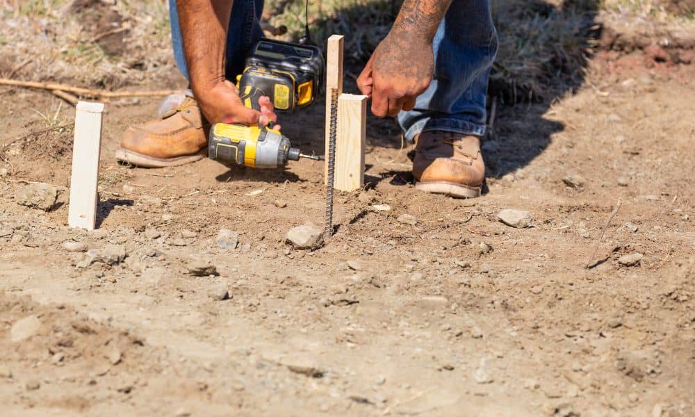
Pay Attention to What Sits Near the Edges
Take a walk around your yard and notice what sits close to the edges of your property. You might see fences, walls, driveways, or even small structures like sheds or patios.
These features matter more than most people think. Since they often sit near property lines, they can affect how the survey is done. In some cases, they even raise questions about placement.
When you point these out early, your surveyor can focus on the right areas. This helps avoid confusion and keeps the work efficient.
Plan Your Timing Before You Call
Timing plays a big role in any project. Yet many homeowners wait until the last minute to order a property line survey.
Surveys take time because they include research, field work, and careful review. So if you have a contractor waiting or a permit deadline coming up, it is best to plan ahead.
Think about your schedule and share it with your surveyor. When they understand your timeline, they can set proper expectations. As a result, your project can move forward without stress.
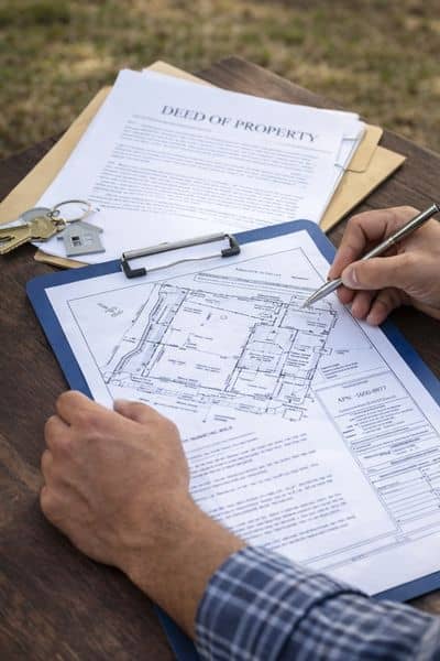
Understand What You Expect to Receive
Not all surveys deliver the same result. That is why it helps to know what you expect before you order one.
Some homeowners only need corners marked on the ground. Others may need visible stakes for construction or a drawing for permits and planning.
If you feel unsure, do not worry. Simply explain your project. A good surveyor will guide you and recommend the right type of output. This way, you avoid paying for something you do not need while still getting what your project requires.
Work With a Licensed Land Surveyor
In California, a licensed land surveyor must handle any official property line survey. Because of this, choosing the right professional is very important.
Look for someone with a valid license and experience in residential properties. Local knowledge also helps. San Diego has a mix of coastal areas, hillsides, and older neighborhoods, and each comes with its own challenges.
When you hire someone familiar with these conditions, you gain confidence in the results. In turn, you reduce the risk of errors or delays.
Take a Few Simple Steps Before the Survey Day
Before the survey begins, a little preparation can go a long way. Even small actions can improve how smoothly things go.
You can start by unlocking gates and clearing access paths. Move anything that blocks key corners. Gather your documents so you can answer questions quickly. It also helps to write down any concerns you want to discuss.
Although these steps seem basic, they support a more efficient visit. As a result, the surveyor can focus on the actual work instead of working around obstacles.
Why Preparation Makes a Big Difference
A property line survey gives you clear information about your land. However, the quality of that process depends on how well you prepare.
When you take time to get ready, everything improves. The survey moves faster, the results become clearer, and your project stays on track. On the other hand, skipping these steps can lead to delays and extra costs.
So, it makes sense to invest a little effort early on.
Final Thoughts
Ordering a property line survey does not have to feel overwhelming. With the right preparation, the process becomes simple and manageable.
Start by understanding your goal. Then gather your details, check your property, and think about timing. After that, choose a licensed professional who knows the area.
When you follow this approach, you set yourself up for a smoother experience and better results.