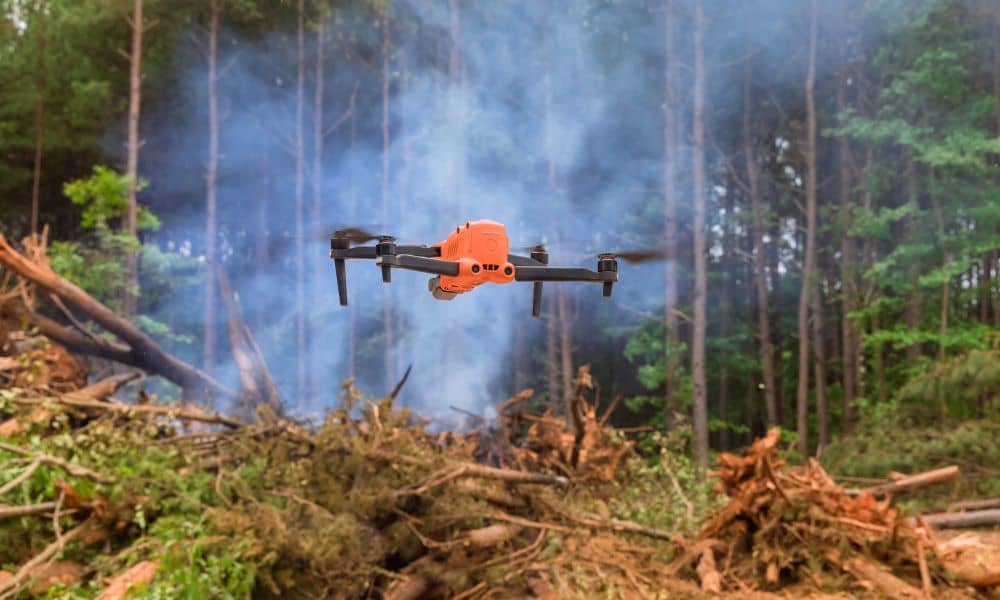
When most people hear about drone surveying, they picture builders saving time or developers mapping large tracts of land. What rarely comes to mind is the risk drones can pose when flown in the wrong place at the wrong time. That reality hit hard in California this month. News broke that a man was sentenced after his hobby drone collided with a Super Scooper plane during the Palisades Fire. Firefighting aircraft had to be grounded, lives were put at risk, and the operator now faces jail time plus heavy fines.
For survey professionals, the story is more than headline fodder. It’s a warning. Every flight we make relies on trust—trust from the public, trust from agencies, and trust from clients who count on safe, legal data collection. When one careless pilot violates that trust, the ripple effects spread to everyone who works with drones.
Why the Story Matters in San Diego
Wildfire season is nothing new here. East County communities like Alpine, Jamul, and Descanso live under constant red flag warnings once the summer heat kicks in. CAL FIRE San Diego has said it plainly: “If you fly, we can’t.” When unauthorized drones enter a wildfire zone, aerial firefighting stops immediately. That delay can cost homes, forests, and even lives.
For those of us who rely on drones as survey tools, that means airspace is never guaranteed. A subdivision survey planned weeks in advance may be grounded the morning of the flight if a new blaze sparks nearby. Clients sometimes ask, “Why can’t you just fly anyway?” This news story shows exactly why. Flying during a Temporary Flight Restriction (TFR) isn’t just unprofessional—it’s illegal.
What is a TFR and Why Should Clients Care?
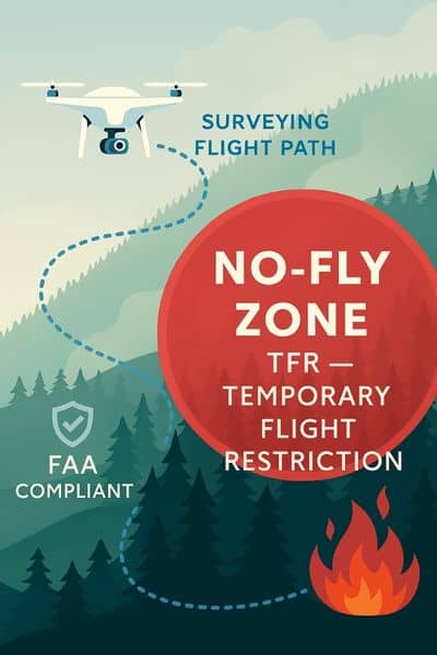
A Temporary Flight Restriction is an airspace closure issued by the Federal Aviation Administration. In Southern California, TFRs are common. They pop up around wildfire operations, VIP visits, air shows, and even military training.
Checking them is simple but critical. Before every flight, survey crews must review the FAA’s TFR map or NOTAM apps to confirm skies are clear. Skipping that step isn’t an option. For clients, this matters because it affects scheduling. A responsible drone surveying company will always check TFRs before flying, even if it means a short delay. That’s how projects stay safe, legal, and reliable.
Lessons for Drone Surveying Crews
The Palisades collision underlined a truth we already knew: drones must never interfere with other aircraft. But turning that lesson into practice takes planning. In San Diego, wildfire season is long, and TFRs can last for days. Professional surveyors adapt by:
- Building flexibility into schedules. We anticipate fire weather days and set backup times to fly.
- Keeping communication open. If a TFR grounds us, clients get updates immediately, not after the fact.
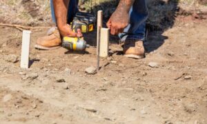
- Using fallback methods. When drones can’t fly, we shift to ground tools like total stations or RTK GPS. This keeps projects moving even when skies are closed.
- Protecting data quality. Once TFRs lift, aerial data can be merged with ground measurements, ensuring accuracy without gaps.
This level of planning is invisible to most clients, but it’s what separates a professional survey team from a hobbyist.
A Realistic East County Scenario
Imagine this: a developer schedules drone surveying for a hillside project. Crews are ready, batteries charged, and permissions secured. Then, overnight, a brush fire sparks two miles away. A TFR shuts down the airspace.
The wrong move would be to fly anyway. A drone in that zone could force CAL FIRE’s helicopters to land, stalling firefighting operations. The right move is to pause, pivot, and adapt. Surveyors might capture accessible ground data that day, then return for aerial mapping once the TFR clears. Deliverables arrive a little later, but safety and compliance remain intact.
Clients often find this flexibility reassuring. It proves their project won’t be tied to one rigid plan. Instead, it’s managed with professional judgment that accounts for real-world conditions.
The Cost of Ignoring the Rules
The man in the Palisades case is now a cautionary tale. His drone caused a midair collision. He was ordered to pay over $150,000 in restitution and faces time behind bars. That’s the personal cost. The broader cost was firefighting aircraft grounded in the middle of an active blaze.
For surveyors, the stakes are similar. Flying inside a TFR without authorization could lead to FAA penalties, lawsuits, or lost licenses. For clients, hiring a surveyor who cuts corners puts your project at risk. If regulators find violations, projects can be stopped, fines imposed, and insurance claims denied.
The lesson is simple: always ask your surveyor about their compliance policies.
Questions Clients Should Ask Their Surveyor
When you hire a team for drone surveying, don’t just ask about cost or turnaround time. Ask the questions that protect your investment:
- How do you check for TFRs before flights?
- What’s your backup plan if drones can’t fly?
- How do you combine ground and aerial data for accuracy?
A good surveyor will answer clearly. If they can’t, that’s a red flag.
Takeaway
The Palisades drone crash may feel distant, but its lessons are urgent for San Diego. One careless flight can put lives at risk, shut down firefighting, and wreck a project’s schedule. Professional drone surveying isn’t just about flying drones—it’s about planning, compliance, and earning trust.
For clients, the message is clear. Hire teams who follow the rules, check TFRs, and build contingency plans. That way, your project stays safe, legal, and on track, even when wildfire season is in full swing.