A lot of homeowners and buyers don’t follow land-use news. But a simple update inside a city office can change how fast you get permits, how long a remodel takes, and even how accurate your next property survey will be. Recently, the City of Vista, which sits inside San Diego County, opened a new position for a Right-of-Way Agent. At first, this might sound small. However, this job directly affects survey work, easements, and boundary checks across the region.
A Staffing Change That Touches Every Corner of the Surveying Process
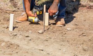
The new Right-of-Way Agent role shows that the city wants better control over land records, maps, and public-works coordination. This position handles legal descriptions, right-of-way questions, title research, and boundary-related documents. These areas sit at the heart of any survey.
Many neighborhoods rely on old maps. Some of those maps date back 40, 60, or even 100 years. When a project starts, surveyors pull information from city offices. They check old plats, easements, and legal descriptions. If the office runs behind or if its records need attention, surveyors spend a lot of time sorting through conflicting details.
A new staff member means the city can sort, clean, and update those records faster. That alone speeds up the entire process. And when surveyors have quick access to accurate information, your property survey moves smoothly.
Why This Matters for Homeowners and Buyers
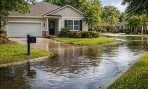
If you live in San Diego County, this change hits close to home. San Diego keeps growing—new subdivisions, ADUs, home additions, backyard upgrades, and full remodels pop up everywhere. All of this depends on clear land data.
Faster answers show up first. When you plan a project, you meet a long list of steps: design, budgeting, scheduling, permits, and surveys. Delays often come from city records that take too long to verify. With more staff in land-use offices, these delays shrink. You get quicker review of public maps, easier access to easement information, faster confirmation of right-of-way lines, and fewer return trips from surveyors asking for more details. As a result, your project stays on track.
You also get fewer surprises. Many homeowners discover issues only after a survey starts. Their fence sits a foot into a neighbor’s yard. A driveway crosses a public right-of-way. An old easement cuts through their backyard, but no one told them. With better staffing, the city can maintain cleaner records. Clean records mean fewer surprises when the surveyor begins work.
This change also supports growing neighborhoods. San Diego continues to expand upward and outward. ADUs, multi-family conversions, and infill projects happen everywhere from Vista to La Mesa. These projects need fast and accurate data because developers run on tight timelines. A more complete and responsive land-use office helps the entire region grow without clogging the system.
How This Helps Surveyors (And Why That Helps You)

Private land surveyors rely on public offices to pull the information needed for every boundary check, ALTA survey, site plan, and subdivision layout. When the city falls behind, surveyors fall behind too. Then homeowners feel the delays.
With more staff in public offices, surveyors finish work faster. They face fewer conflicts in old maps, get answers from the city more quickly, and complete reports without last-minute corrections. Better staffing gives surveyors the tools they need to give you better service.
It also improves accuracy. Surveyors can only confirm what records show. If those records need cleaning, updates, or fresh verification, even the best surveyor hits a wall. The Right-of-Way Agent helps clear those walls, which leads to cleaner and more reliable survey results.
Why This Matters During a Real Estate Purchase
If you’re buying property, you already know the market moves fast. Homes get multiple offers. Buyers need quick inspections. And lenders need supporting documents without delay.
A property survey often becomes a key part of the process, especially for buyers who want clarity on fences, structures, additions, and lot lines. Better city staffing helps buyers because survey timelines shrink, boundary questions get resolved faster, lenders get clearer information, and closing stays on track.
Nothing stresses a buyer out more than waiting for a survey while the closing date gets closer. A shorter, smoother path helps deals move forward without drama.
What This Means for Construction and Renovation Projects
Planning an ADU? Building a home addition? Replacing a fence? Installing a retaining wall? All of these require accurate property lines. Many also require detailed measurements and site checks.
A strong land-use office makes these steps easier. With more staff, your designer or architect gets better base maps, your surveyor gets quicker access to city records, your permit approval happens sooner, and you avoid conflicts with neighbors or city inspectors. In construction, time matters. Delays cost money. A better-staffed office helps lower those risks.
How Homeowners Can Take Advantage of This Change
You can make the most of this moment with a few simple steps. Order your property survey early. Even with better staffing, San Diego remains busy, so getting ahead helps. Talk to your surveyor about timeline improvements and ask what this means for your project. Review your property’s history, especially if you live in an older neighborhood. Old records often hide small issues that a new survey brings to light.
This staffing change also gives you a chance to plan smarter. If you’ve been waiting to start a project, this could be the window that keeps your schedule tight and clear.
A Small Move With Big Effects
A single staffing change inside a city office may look simple. But it creates real benefits for people planning projects, buying homes, or solving property issues. When San Diego’s land-use teams grow, surveyors get better support. You get faster answers, clearer information, and fewer problems down the road.
Your next property survey might feel easier than ever—and this quiet but important update in Vista plays a big part in that.