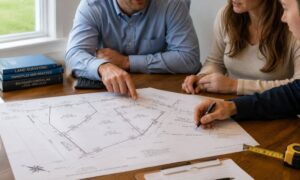
A sloped yard in San Diego can look simple at first. You see the drop, you picture a clean wall, and you expect the job to move fast. Then things shift. The ground isn’t even. The wall design keeps changing. Costs creep up. It starts to feel messy. That usually happens when the project begins without clear site data. A topographic survey fixes that. It shows how your land actually sits before any design work starts. Once you have that picture, the whole process makes more sense.
Why a Topographic Survey Comes Before the Wall
A retaining wall doesn’t just hold soil. It deals with pressure, slope, and space all at once. Even a small height difference can change how the wall should be built. You can’t judge that by standing in your yard.
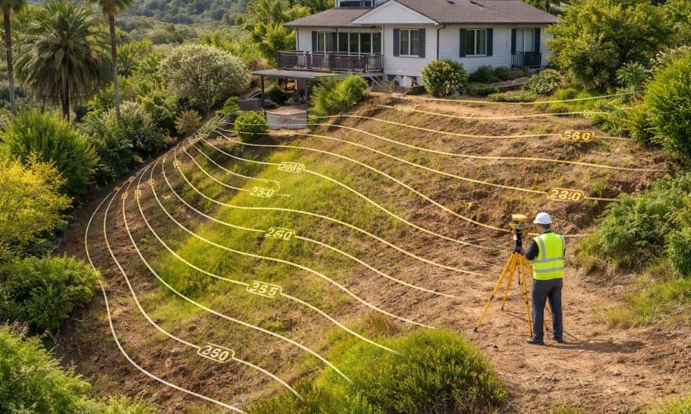
A topographic survey maps the ground with exact elevations. It shows where the land rises, where it drops, and how those changes connect across the site. With that in hand, an engineer can design something that fits the real conditions, not a rough guess.
When this step gets skipped, the design often needs changes later. That slows things down and raises the cost.
What Your Land Is Really Doing Beneath the Surface
Most slopes are not smooth. They twist, dip, and shift in ways that are hard to see. A yard might look like one steady angle, but the ground can change every few feet.
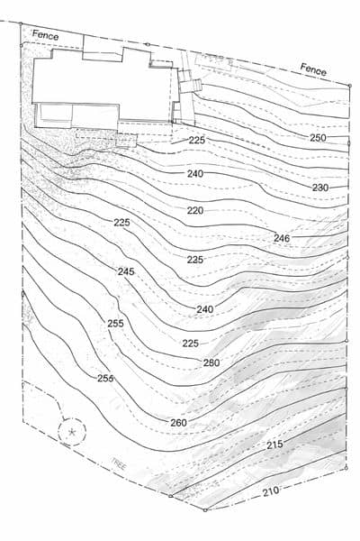
A good topographic survey captures those small shifts. It draws contour lines that show the shape of the land. Where the lines sit close together, the slope is steep. Where they spread out, the ground is softer. These details help guide the wall’s height and position.
The survey also marks where the ground changes direction. These points matter more than people expect. A wall placed a few feet off can miss the area that actually needs support.
How Elevation Shapes the Wall Design
Your house, patio, and driveway all sit at different levels. Those differences matter when planning a retaining wall. The wall has to match those heights in a way that keeps the space usable.
A topographic survey shows how these parts of the property connect. It gives the engineer a clear view of how far the ground drops from one point to another. That helps decide how tall the wall should be and where it should sit.
Without that data, the design may not line up with the rest of the yard. That leads to changes later, which is something you want to avoid.
Why Surface Details Change the Plan
Your yard is full of features that affect the layout. Fences, walkways, and existing structures all take up space. Even small items can limit where a wall can go.
A detailed topographic survey includes these features. It shows their position and how they relate to the slope. This helps avoid tight spots or conflicts during the design stage.
When these details are missing, the plan can run into issues once work begins. That’s when delays start to build.
How Water Movement Fits Into the Picture
Water always follows the slope. It moves across the ground based on elevation, not guesswork. If the wall design ignores that, water can build up in the wrong place.
A topographic survey shows how the ground tilts across the lot. This helps the engineer plan how water will move once the wall is in place. It keeps the design balanced so the wall handles both soil and water pressure.
This step doesn’t need to be complex. It just needs to be accurate.
Why Sloped Lots in San Diego Need Extra Care
San Diego has many homes on uneven ground. Some sit near hills. Others rise above street level. Many have limited space between structures.
Because of that, small changes in elevation matter more here than on flat land. A few inches can affect how the wall fits into the space. It can also change how the yard feels once the work is done.
A topographic survey brings clarity to these conditions. It helps avoid surprises that come from guessing.
When to Get a Topographic Survey
Timing plays a big role in how smooth the project feels. The survey should come before any design work starts. That way, the engineer works with real data from the beginning.
If the survey comes later, parts of the design may need to be redone. That adds time and cost. Getting it early keeps everything on track.
Making Sure the Survey Matches the Job
Not all surveys are the same. For a retaining wall on a slope, the survey needs enough detail across the whole site. Partial data won’t help.
Talk with the surveyor about the plan. Make sure they understand the goal. When the survey matches the project, the design stage moves faster and feels more stable.
Bringing It All Together
A retaining wall depends on the ground beneath it. If you don’t fully understand that ground, the project becomes harder than it should be.
A topographic survey gives you that understanding. It shows how your land sits, how it connects, and how it should guide the design. With that in place, the wall becomes a planned solution, not a guess.
For a sloped lot in San Diego, that difference matters.