Across California, many property owners share the same problem: projects that should move forward end up stuck in review. CEQA was created to protect the environment, but over time it has also slowed down permits because decisions rely on old maps, missing records, or unclear site data. Recent CEQA reforms aim to fix that. In places like San Diego, these changes are quietly shifting how lidar mapping is used during the permit process.
The goal is not to skip reviews. The goal is to reduce guesswork. And guesswork is where delays usually begin.
When permits slow down because the land is unclear
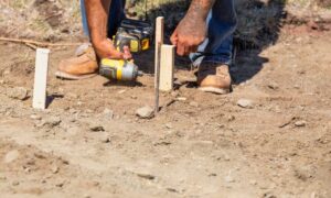
Many projects stall because agencies can’t clearly see what a site looks like today. Is the slope steeper than expected? Has past grading changed how water flows? Are elevation changes shown on old plans still accurate?
Older surveys don’t always answer these questions well. Some rely on limited ground shots or outdated contour lines. As CEQA timelines shorten, reviewers are looking for clearer data earlier. That’s why lidar mapping is becoming more valuable. It shows current ground conditions in detail, which helps reviewers make decisions without going back and forth for months.
In San Diego, where hillsides, canyons, and coastal land are common, this level of detail matters more than ever.
Ownership risk is not always about property lines
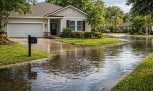
Most people think land risk only means boundary disputes. But CEQA-related risk often comes from the land itself. A property can be fully within its boundaries and still face issues tied to slope stability, erosion, or drainage patterns that were never clearly documented.
LiDAR data can reveal small terrain changes that affect how a site is reviewed. Once a project triggers extra environmental review, costs and delays grow fast. With CEQA reforms pushing for quicker decisions, having clear site data early helps prevent surprises later.
Old records create real problems during review
California is encouraging more infill development, especially in cities like San Diego. The problem is that many older lots have incomplete records. Past grading, fill work, or site changes may not be shown clearly on older plans.
Lidar mapping helps fill those gaps. It captures what exists now, not what older drawings say should exist. When agencies must move faster, current data carries more weight than paperwork from decades ago. This shift favors surveys that show real conditions instead of assumptions.
Environmental findings can affect future ownership
CEQA reviews don’t usually deal with title issues, but the results can still affect property value and future sales. If a site gains new environmental limits after review, those limits may surprise buyers or lenders later.
Clear terrain data helps align environmental decisions with ownership expectations. When the physical features of a property are well documented upfront, there’s less risk of confusion about what can be built later. This is especially important for properties near slopes, bluffs, or waterways.
Better data also reduces risk and mistakes

As CEQA reviews speed up, agencies are paying closer attention to data quality. If plans don’t match real conditions, reviewers notice. In some cases, this can raise concerns about accuracy or even misrepresentation.
Using lidar mapping reduces that risk. It gives reviewers a clear picture they can trust. That protects agencies, property owners, and future buyers from costly errors and delays.
What this means for everyday property owners
You don’t have to be a large developer to feel these changes. Homeowners planning additions or small projects often face CEQA requirements they didn’t expect. Faster reviews sound great, but only when the site data is solid.
As California updates how CEQA works, clear land information is becoming more important. In this environment, lidar mapping is not just a technical tool. It helps projects move forward with fewer delays and fewer surprises.
For property owners, that clarity can make all the difference. When the land tells a clear story, approvals are easier to reach—and that’s exactly what CEQA reform is trying to achieve.