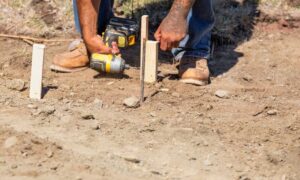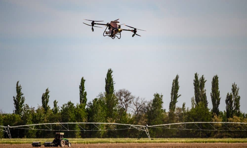
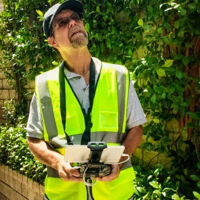
A UAV Survey used to be simple. A surveyor planned the flight, collected the data, processed the files, and delivered the results. For years, that workflow worked well. However, things have changed. New drone rules, supply concerns, and airspace limits are now forcing surveyors to rethink how they work. As a result, many firms are rebuilding their UAV survey workflows to stay compliant and to protect long-term projects.
This shift is not about chasing the latest technology. Instead, it is about reducing risk for clients and making sure survey data stays reliable from start to finish.
Why the UAV Survey Landscape Is Shifting
In recent months, drone policies and equipment rules have created uncertainty across the surveying industry. Some drone models face tighter controls. Others have longer lead times or limited parts. At the same time, airspace oversight continues to increase, especially near cities and sensitive areas.
Because of this, surveyors can no longer assume that the same drone, sensor, or setup will be available for every phase of a project. For clients, that creates a real concern. If Phase One uses one setup and Phase Two uses another, results may not line up.
Therefore, surveyors are adjusting how UAV survey work gets planned, documented, and delivered.
Why “Business as Usual” No Longer Works
In the past, speed mattered most. If a drone could fly quickly and collect dense data, that was enough. Today, speed alone is not enough.
For example, a survey that works fine today may not meet future compliance needs. Also, if a drone platform becomes unavailable halfway through a project, restarting with a new system can cause problems. Elevations may not match. Point density may change. Even small differences can lead to redesigns or delays.
As a result, surveyors now focus less on individual flights and more on full project workflows.
Compliance Is Now Part of the Survey Process
Many people think compliance only applies to flying the drone. In reality, compliance now affects the entire UAV survey process.
Surveyors must think about:
- Equipment approval and availability
- Flight permissions and airspace rules
- Data accuracy and repeatability
- Documentation that supports future phases
Because of this, modern UAV survey workflows include more planning before the drone ever leaves the ground. Surveyors define standards early so that every survey phase follows the same rules.
This approach protects both the surveyor and the client.
Continuity Matters More Than Ever
Most projects do not stop after one survey. Developments often include multiple phases, design updates, and construction changes. Therefore, continuity matters.
When UAV survey workflows lack continuity, problems appear later. Data may not match. Engineers may question results. Contractors may need clarifications. All of this slows projects down.
To avoid these issues, survey firms are rebuilding workflows with continuity in mind. That means using repeatable methods, stable control points, and consistent processing steps. Even if equipment changes, the results stay reliable.
How Surveyors Are Rebuilding UAV Survey Workflows
Surveyors are not waiting for problems to appear. Instead, many are taking proactive steps.
First, they are designing workflows that work across multiple drone platforms. This reduces dependence on one model or brand. Second, they are strengthening ground control plans. Reliable control helps tie data together, even when sensors change.
Next, surveyors are standardizing processing settings. Consistent processing reduces variation between survey phases. Finally, they are improving documentation. Clear records make it easier to defend results and continue work without confusion.
Together, these changes create a more stable UAV survey process.
What This Means for Clients
Clients may not notice these changes right away. However, they feel the benefits over time.
A rebuilt UAV survey workflow means fewer delays. It also means better consistency across project stages. In addition, it reduces the risk of resurvey costs caused by data mismatches.
Most importantly, it gives clients confidence. They know their survey provider can adapt to change without disrupting the project.
Questions Clients Should Ask Before Hiring a UAV Survey Provider
Because workflows matter more now, clients should ask better questions.
For example:
- How do you handle multi-phase UAV survey projects?
- What happens if your drone platform changes?
- How do you keep survey results consistent over time?
- How do you manage compliance without delaying work?
These questions help clients choose a surveyor who plans ahead rather than reacts later.
Why Planning Beats Speed in Today’s UAV Survey Work
Fast data collection still matters. However, planning now matters more.
A rushed UAV survey may look fine at first. Yet problems often show up months later. By then, fixing them costs more time and money.
On the other hand, a well-planned workflow supports long-term success. It aligns with regulations. It supports design decisions. It protects construction schedules.
That is why many surveyors now say stability is more valuable than speed.
The Bigger Picture: Trust and Professional Responsibility
At its core, rebuilding UAV survey workflows is about trust. Clients trust surveyors to deliver accurate, dependable data. Surveyors, in turn, have a responsibility to adapt as conditions change.
By rebuilding workflows for compliance and continuity, survey firms protect that trust. They show clients that they understand both current risks and future needs.
Final Thoughts
UAV survey work is not becoming harder. It is becoming more thoughtful. New rules and market shifts have pushed surveyors to improve how they plan, document, and deliver results.
For clients, this is good news. A rebuilt UAV survey workflow means better protection, smoother projects, and fewer surprises. In today’s environment, that reliability matters more than ever.
If your project depends on UAV survey data, choose a provider who builds workflows for the future, not just for today.